Desert Invasion - U.S.
Pictures of illegal aid stations for illegal aliens
See road map.
Sierra Vista is a small town 15 miles north of the Arizona-Mexico border, on the southeast Arizona border. The area surrounding Sierra Vista is well known as a corridor for illegal entry into the United States.
The Bureau of Land Management began allowing water stations to be placed on public U.S. BLM land in April, 2004, in violation of U.S. law.
See this article.
As thousands every day cross our borders illegally in pursuit of economic gain and political promises of amnesty, organizations and church groups provide aid and thereby induce further illegal entry.
Water is never denied in the desert, but this action sends the wrong message. It would be much better, for example, to provide emergency call stations that would summon the U.S. Border Patrol who could provide emergency water, medical assistance, and swift deportation.
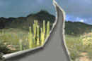
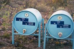
This water station is located on private property about 15 miles north of the Mexican border.1
|
|
|
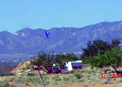
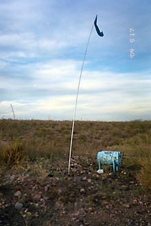
Water cache provided by American citizens for illegal aliens, in violation of U.S. law. Note the flag to guide illegals. Late May, 2004.2
| |
|
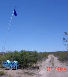
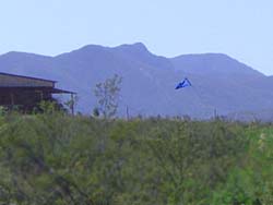
This station is located on the Arizona-Mexico border road approximately 61 yards north of the border fence. June 12, 2004.1
|
|
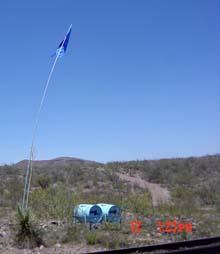
This water station is located 22 yards north of the border fence. June 12, 2004.1
|
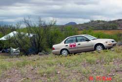
Aid station for illegal aliens east of Naco. The sticker on the car reads "Samaritans", almost certainly the same group that has the
website www.nomoredeaths.org.
|
|
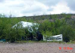
Aiding and abetting station on a Border road. The banner reads "no more deaths" - an admirable and humane goal, as long as illegal aliens are apprehended and returned to their country of origin (which is emphatically not the case with these aid stations).
|
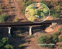
American Border Patrol took this photo on July 1, 2005 of one of the many Humane Borders water stations along the border in Arizona. This one is in Mexico about 200 yards south of the border.
|
|
|
1 Photos 2004 Henry Harvey
2 Photos by D.A. King, www.THEAMERICANRESISTANCE.com.
|