Desert Invasion - U.S.Pictures of American Border Patrol UAV on the Arizona border
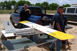
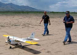
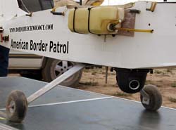
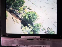
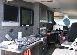
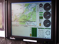
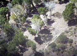
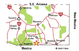
American Border Patrol, a private organization in Cochise County, Arizona, has recently completed a year of unmanned arial border patrols near Palominas. The UAV (Uncrewed Reconnaissance Vehicle) is essentially an oversized model airplane, equipped with state-of-the-art cameras, navigation, communications and GPS equipment. The UAV works in conjunction with ground sensors that indicate where people are moving through the desert. The UAV has documented suspected illegal aliens moving along the San Pedro River and Huachuca Mountain corridor west of Naco, Arizona. Border technologies Inc., a private enterprise spin-off of American Border Patrol, has invested nearly $250,000 on UAV development and has created a commercially-viable navigation system.
Each Border Patrol Hermes aircraft costs $2 million, whereas the American Border Patrol Border Hawk costs only approximately $30,000 per aircraft. For the cost of two Hermes aircraft, American Border Patrol could fly up to 100 Border Hawk aircraft, including control stations and sensors - a decided advantage along the 300 miles of border covered by the Border Patrol Tucson Sector. Glenn Spencer, head of American Border Patrol, is convinced that his effort will help the Border Patrol do a better job, stating: "We have demonstrated that a low-cost unmanned aerial vehicle can be used to patrol the border and find suspected border intruders. Beyond that, we've created a means for an independent assessment of the problem. We're able to put the images up on the Internet to give an independent assessment directly to the American people of the effectiveness of our border patrol." For additional information, see American Border Patrol website, pictures of first mission and Border Cam alert. Also see this article comparing the drones.
1 Photos 2004 Fred Elbel |
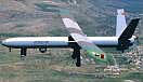 The U.S. Border Patrol plans to launch in June, 2004, two new remote-controlled, camera-equipped aerial vehicles. The U.S. Border Patrol Hermes 450 UAV's can fly at 18,000 feet at speeds 90 mph and can stay aloft for nearly 20 hours with a payload of more than 200 pounds. The aircraft is 33 feet long and weighs 400 pounds.
(See
The U.S. Border Patrol plans to launch in June, 2004, two new remote-controlled, camera-equipped aerial vehicles. The U.S. Border Patrol Hermes 450 UAV's can fly at 18,000 feet at speeds 90 mph and can stay aloft for nearly 20 hours with a payload of more than 200 pounds. The aircraft is 33 feet long and weighs 400 pounds.
(See